Toronto has many parks and trails that are easily accessible despite being a sprawling urban metropolis! Our city is home to extensive trail networks that offer a variety of trail types and experiences. There are multi-use trails, natural trails, discovery walks and hundreds of wonderful parks to enjoy. It’s also a great opportunity to explore Toronto’s natural and cultural heritage. See why our city is called a “A City Within A Park” as you stroll through our list of the best parks and pathways for hiking in Toronto.
Note: Multi-use trails offer a shared experience for a variety of pedestrians, runners, cyclists, in-line skaters and others. Just make sure you practice good trail etiquette! Our city also offers natural trails, typically unpaved, that are great for hiking, biking and connecting with the great outdoors. The trail network also features many self-guided Discovery Walks that link ravines, parks, beaches and neighbourhoods. Find more information of the City of Toronto’s numerous trails here!

Don River Valley Park
A vast network of trails and parks follow the Don River stretches all the way from the top of East York and down to the Portlands by Lake Ontario. Popular areas include Crothers Woods, Evergreen Brickworks, Chorley Park Trail Connection, Moore Park Ravine and Don Valley Brick Works Park. The Don Valley is beautiful year-round but it especially comes alive in autumn with colourful foliage.
Spadina Quay Wetland & Toronto Music Garden
Spadina Quay Wetland is a uniquely constructed wetland that has established a natural pike spawning habitat. It sits beside the Toronto Music Garden on the waterfront, a cozy spot which is even inspired by Bach’s First Suite for Unaccompanied Cello.
Toronto Islands
If you’re looking to really escape the city while still staying downtown, head across Toronto Harbour in Lake Ontario to the “The Islands”. Tear yourself away from the postcard-views of the harbourfront, and wander around Centre Island‘s beaches, playgrounds and Centreville Amusement Park, or venture further to the wilder reaches on Ward’s Island and Hanlan’s Point.

Glen Stewart Ravine
You’ll find a lovely 11-hectare ravine in The Beach neighbourhood. It’s home to a wide range of plant and bird life and you’ll see it all from the elevated boardwalk. As the City’s Official Plan lists it as an Environmentally Significant Area, it has seen a number of recent infrastructure improvements.
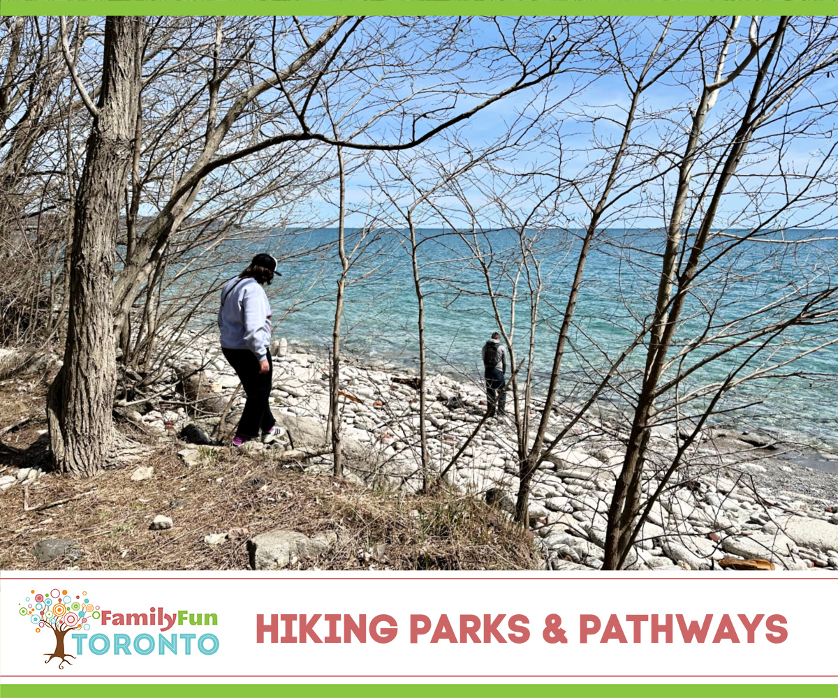
Tommy Thompson Park (pictured)
This natural park was created by downtown construction crews tossing brick, concrete and other rubble along a road jutting out into the lake. It didn’t take long for nature to take over and it has now been designated as an Environmentally Significant Area and an Important Bird Area. Even better, you are rewarded with a secretly spectacular view of the downtown skyline!

High Park
Best known with the TikTok crowd for its springtime cherry blossom blooming, there are still plenty of quiet areas where you can feel far from crowds. You can walk all the way from Bloor to the lake or take a long stroll around Grenadier Pond.

Don Mills Trail
A long path east of Leslie Street between York Mills and Eglinton Ave. East follows the roadbed of a former railway line.
Downsview Park
Downsview Park is a 291 acre parkland that integrates a mix of forests, ponds, trails, active and passive play areas, sports fields, gardens and related uses. There are regular special events throughout the year, particularly for Earth Day, and four nature programs run regularly: A Walk In The Park, Junior Forest Explorers, Nature Connection and Wellness Walks.
Kay Gardner Beltline Trail
A former rail line is now a wide biking and hiking trail that covers a good portion of Midtown from Caledonia Road to a section in historical Mount Pleasant Cemetery.
Charles Sauriol Conservation Area and Moccasin Trail Park
Famous for its extremely photogenic rainbow tunnel in, this 15-hectare park area at Lawrence Avenue East and the Don Valley Parkway features walking paths through a naturalized ravine forest.
Sunnybrook Park
The City of Toronto developed Sunnybrook Park from a 154-hectare country estate in 1928. It is located north of Leaside and south of the Bridle Path. Check out the preserved Kilgour family barns, which currently serve as a public riding school! It’s also a top spot to see birds in the birds of Toronto and its Glendon Forest is an Environmentally Significant Area because of its plant and animal diversity.

Humber River Recreation Trails
Humber River provides a breeding habitat for ducks, turtles and fish and it received a Canadian Heritage River designation in 1999. It is also a significant corridor for migratory song birds and monarch butterflies (there’s even an official butterfly habitat at Humber Bay Park East). More than 60 species of fish live in the river including such sport fish as trout, pike and salmon. Its parks run continuously from the lake all the way up to Highway 407, including South Humber Park, Humber Marshes (one of the few remaining river mouth marshes in Toronto), Lambton Woods, Scarlett Mills Park and West Humber Parkland (known for its many bike trails).
Colonel Samuel Smith Park
This park features a network of paths and the city’s longest ice skating trail. This loop also works great for roller skating in warmer weather. It’s also one of Toronto’s most popular birding destinations!

Rouge National Urban Park
Rouge National Urban Park is Toronto’s largest park and the first of its kind in Canada. The Rouge stretches from the Oak Ridges Moraine to the shores of Lake Ontario and covers over 40 square kilometres. It includes Canada’s largest wetland, National Historic Sites, wilderness areas, historic farmlands, fishing areas and a sandy beach.
Scarborough Bluffer’s Park
Thousands of years of glacial activity and erosion by the currents of Lake Ontario formed the beautiful natural area, now known simply as The Bluffs. In warmer temperatures, its beach is extremely popular.
Taylor Creek Park & Warden Woods
The ravine system veers east into Scarborough as it continues up the Don Valley from downtown. Take a hike or bring your bike in the spring, summer and fall to use one of the many paths that give a route to follow through this park.
Wander into our full list of Parks & Parkways here!


